28. Bird, P. (1992) Deformation and uplift of North America in the Cenozoic era, in: K. R. Billingsley, H. U. Brown, III, and E. Derohanes (eds.), Scientific Excellence in Supercomputing: the IBM 1990 Contest Prize Papers, Baldwin Press, Athens, Georgia, v. 1, pp. 67-105.
Abstract. Progress in science requires experiments, and the only way to experiment with continental deformation is to numerically solve the governing equations. A realistic model of practical computational speed has been achieved by a combination of multilayer 2-dimensional finite element methods (solving stress-equilibrium in the lithosphere), analytic methods (determining thickness and temperature changes), and finite difference methods (predicting lateral extrusion of soft lower crust). These models incorporate realistic frictional/creeping rheology, compositional layering of the lithosphere, possible detachment on horizontal planes, and feedback between deformation and heat conduction.
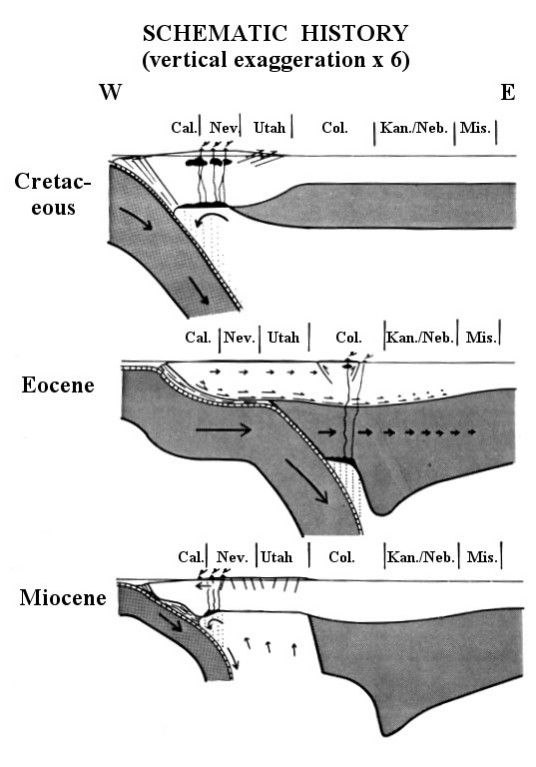
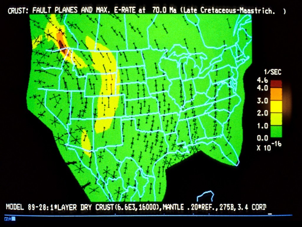
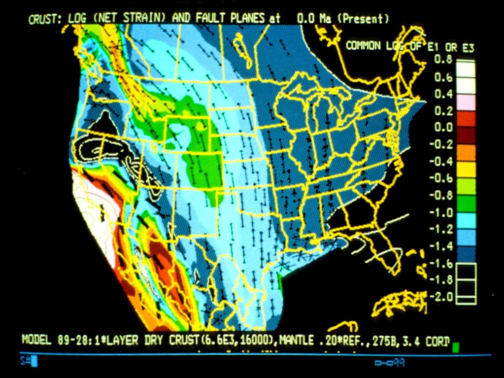
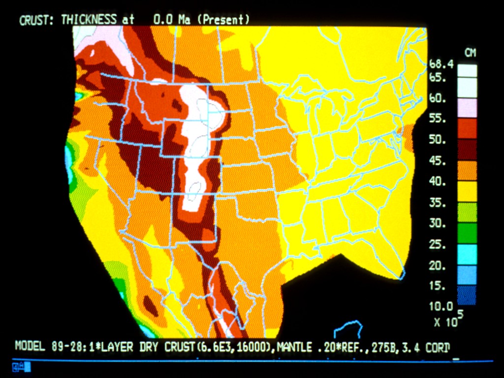
In the method's first application, 18 simulations were performed of the tectonic history of North America during the last 85 million years when the Rocky Mountains formed (by compression), the Great Basin crust was thinned (by extension), and the continental interior was uplifted (mechanism unknown). The boundary conditions were obtained from published rigid-plate kinematic models of the ocean basins and included horizontal subduction of the Farallon and/or Kula plates. In every model, shear traction from horizontal subduction caused detachment and eastward transport of the mantle layer of North American lithosphere. Next, the crustal roots of the Mesozoic coastal cordillera were sheared off and transported toward the Rocky Mountain foreland. Meanwhile, the resulting horizontal compressive stress caused crustal shortening (and further thickening) in the Rocky Mountain states. By systematic adjustment of the assumed rheological constants, strains of the correct magnitude in the correct states and epochs were "predicted." In the last 30 million years of each simulation, horizontal subduction ceased, and strike-slip faulting began along the southwest Pacific margin. Each model showed some approximation of the actual extension of the Great Basin, plus the large clockwise rotations of southwestern California that have been recently documented.
Principal scientific results to date include: (1) verifying the hypothesis that horizontal subduction caused the shortening of the Rocky Mountains; (2) extending the hypothesis to explain the mechanism of continental uplift; (3) modeling the mechanism for heating and weakening of Great Basin crust, and (4) determining an in-situ rheology for the North American plate.
PDF of final manuscript & figures, including 2 color plates
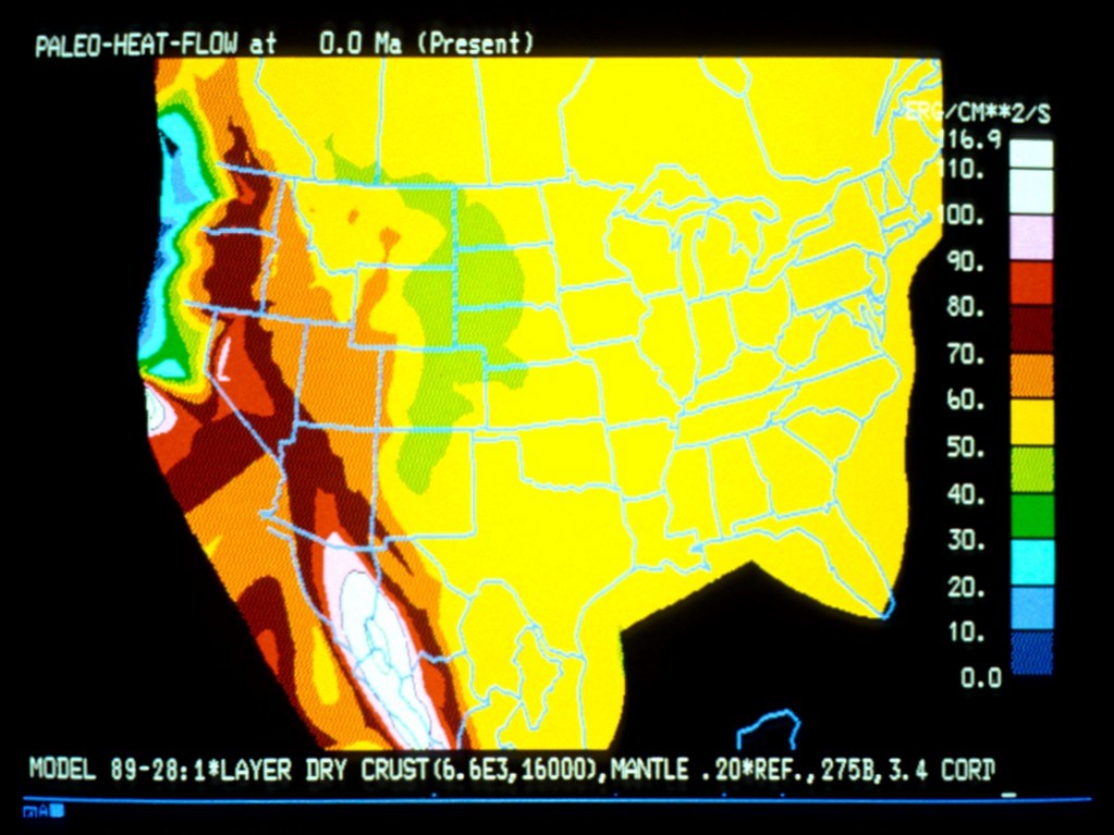
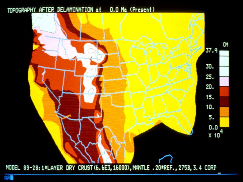
BROWSE THE ATLAS of images associated with Laramy model 89-28 (the preferred dynamic F-E model), including:
Plate reconstructions of the subducted Farallon and Kula plates (40 maps; both Northern and Southern options)
Cretaceous cordillera reconstructed for the initial conditions at 85 Ma (12 maps)
model 89-28 graphics (98 maps, similar to those above, including “film-strip movies” of important variables)
Caveat: All maps depict dynamic finite-element model predictions, not necessarily actual geologic history! Some model predictions were incorrect. (In other cases, the predicted events actually occurred, but in an adjacent state.)